An official website of the United States government.

Official websites use .gov
A .gov website belongs to an official government organization in the United States.

Secure .gov websites use HTTPS
A lock ( ) or https:// means you've safely connected to the .gov website. Share sensitive information only on official, secure websites.

Monitoring

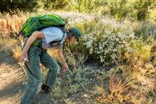
Monitoring for invasive plants

Provides selected Monitoring resources from agencies and organizations with an interest in the prevention, control, or eradication of invasive species. Monitoring (surveillance) is an important part of controlling invasive species. Monitoring can identify new populations of invasive species while they are still small.

Spotlights

  • Have Plant Protection Project Ideas? Apply for Funding Today!

    • Jun 65, 2024
    • USDA. Animal and Plant Health Inspection Service.

    • The U.S. Department of Agriculture’s (USDA) Animal and Plant Health Inspection Service (APHIS) invites stakeholders to tap into their creativity and submit innovative proposals for fiscal year (FY) 2025 Plant Protection Act Section 7721 (PPA 7721) funding. APHIS is funding projects that protect American agriculture and natural resources this summer, and it’s time to apply! Applicants can submit suggestions for Plant Pest and Disease Management and Disaster Prevention Program funding from June 5 through July 31, 2024.

  • eDNA Research Continues Expanding

  • Bipartisan Infrastructure Law Investments Combine Science and Technology to Track Biological Threats in US Waters

    • Nov 9, 2022
    • DOI. United States Geological Survey.

    • The U.S. Geological Survey announced it has signed a cooperative agreement with the Monterey Bay Aquarium Research Institute, or MBARI, to develop portable robotic DNA samplers capable of independently monitoring for living threats in the rivers and streams without constant support from researchers.

      With new investments from President Biden’s Bipartisan Infrastructure Law (Investing in America -- Build.gov), the partnership will help advance detection of invasive species, pathogens and parasites which cause ecological and economic damage to aquatic systems. These organisms can wreak havoc on our waterways, threaten commercial and recreational fishing industries and promote the spread of zoonotic diseases that can impact humans.

  • DNA From Thin Air: Could Invasive Species be Monitored Using Airborne DNA?

    • Jan 21, 2022
    • CAB International. Invasives Blog.

    • Invasive species are notoriously challenging to track due to their ability to rapidly spread from one habitat to another, whilst their impacts on endangered species can be even more difficult to detect. Two new studies published in the journal Current Biology have now shown that it is possible to accurately identify a variety of animal species over distances of hundreds of metres by sampling environmental DNA (eDNA), or DNA traces shed by animals into the surrounding air.

  • Environmental DNA from Bats may Help Track Killer Fungus

    • Aug 23, 2022
    • USDA. FS. Research and Development.

    • Assays of environmental DNA — traces of genetic material found in air, soil, and water — may improve scientists’ ability to detect bat roosts and track the spread of white-nose syndrome, a disease caused by a killer fungus spread easily in the close quarters of hibernacula. In this research, scientists experienced success in detecting bats in field collected samples of environmental DNA, though the technology is still in the experimental stage.

  • Environmental DNA Research Sheds Light on Invasive Species

    • Mar 4, 2022
    • DOI. United States Geological Survey.

    • United States Geological Survey Science is Refining eDNA Techniques and Developing New Applications. Research by the U.S. Geological Survey is leading to new techniques in the use of environmental DNA, or eDNA, to detect invasive species and their spread.

  • H.R.9597 - Wildlife Disease Surveillance for Pandemic Prevention Act of 2022

    • Dec 15, 2022
    • Congress.gov

    • Introduced on December 15, 2022 (117th Congress; 2021-2022), by Rep. Katie Porter [D-CA-45], this bill would create a coordinated domestic wildlife disease surveillance framework for State, Tribal, and local governments to monitor and respond to wildlife disease outbreaks to prevent pandemics, and for other purposes.

  • Message in a Molecule: How We’re Using Environmental DNA to Protect Aquatic Species

    • Feb 3, 2022
    • Nature Conservancy.

    • Advanced tools help our scientists detect native and invasive species in Lake Ontario and the St. Lawrence River.

  • Shedding Light on Shedded Cells: Using eDNA Sampling for Surveillance of Invasive Species

    • Apr 2022
    • USDA. Forest Service.

    • A framework from Rocky Mountain Research Station scientists can help managers decide if, when, and how to use eDNA sampling technology for invasive species monitoring or surveillance.

      Citation: Morisette, Jeffrey; Burgiel, Stas; Franklin, Thomas; Wilcox, Taylor. 2022. Shedding light on shedded cells: Using eDNA sampling for surveillance of invasive species. Connected Science. Fort Collins, CO: U.S. Department of Agriculture, Rocky Mountain Research Station. 2 p.

  • State Seeking Volunteers to Help Monitor Vermont’s Lakes and Ponds

    • Aug 5, 2022
    • Vermont Agency of Natural Resources. Department of Environmental Conservation.

    • This summer, the Vermont Lakes and Ponds Program is seeking volunteers to help monitor and collect information about lakes and ponds in the state. With over 800 lakes and ponds, volunteers are key to the success of the program’s lake monitoring efforts. Volunteers can be found statewide greeting lake visitors, inspecting boats, collecting water samples, tracking algal or cyanobacteria blooms, reporting aquatic invasive species, and more. For general information, interested parties are welcome to visit the volunteer webpage.

  • Tracing the Source: How Did Invasive Northern Pike Arrive in the Columbia River Basin?

    • Nov 2022
    • USDA. FS. Rocky Mountain Research Station.

    • Northern pike are native to Alaska, Canada, and much of the central and eastern continental United States. Genetic evidence reveals the role of human transport in the spread of invasive northern pike in the Columbia River basin.

  • PATHMAP: A New Interactive Tool for Tracking Tree Fruit Diseases, Disorders, and Insect Pests

    • Dec 16, 2021
    • USDA. ARS. Down on the Farm.

    • ARS researchers created a new tool, called Pathogen and Tree Fruit Health Map (PATHMAP), which will connect growers in different states and allow them to share important data regarding tree fruit diseases, disorders, and insect pests. This online interactive tool will enable growers to modify and adjust their pathogen and pest control programs based on real-time data, provide quick access to time-sensitive data, give them access to experts in the field, and provide access to previous years observations and track current diseases, disorders and pests.
      See also: Down on the Farm archives

  • Port of New Orleans Finds Invasive Insects in Wood on Deck of Foreign Vessel

    • Jul 28, 2021
    • DHS. Customs and Border Protection.

    • A cargo ship was ordered to leave the U.S. waters after U.S. Customs and Border Protection (CBP) agriculture specialists at the Port of New Orleans discovered invasive insects found in the wood used to secure its previous cargo offloaded earlier in Mexico.

      The wood used to pack the aluminum shipment was found to be infested with five separate pests, two of which required action. Two of the pests discovered pose an agricultural threat to the U.S. They were positively identified by USDA entomologists as Cerambyciae and Myrmicinae.

  • Western Governors' Association Launches Invasive Species Data Mobilization Campaign

    • Dec 18, 2020
    • Western Governors' Association.

    • The Invasive Species Data Mobilization Campaign of the Western Governors’ Association seeks to encourage national, state, and local land managers, private landowners, and non-governmental organizations to enter previously unavailable data into new or existing invasive species data management platforms using Findings and Recommendations (May 15, 2018) [PDF, 244 KB] developed by WGA and invasive species data experts. WGA and the North American Invasive Species Management Association launched the campaign in December 2020 with a webinar featured representatives from the four existing data platforms -- EDDMapS, iMapInvasives, BISON (see note below), and USGS NAS -- discussing the importance of invasive species data standardization and sharing.
      Note: GBIF-US was formerly hosted at BISON.USGS.gov. The BISON website was taken down on December 17, 2021 and users are redirected to www.gbif.us.

  • Center for Invasive Species and Ecosystem Health Mobile Applications

    • University of Georgia. Center for Invasive Species and Ecosystem Health.

    • Center staff design and publish comprehensive mobile applications that engage users with invasive species, forest health, natural resource and agricultural management. Previous apps were designed for specific areas of the U.S. Two new apps are available for reporting invasive species throughout the U.S.:

      • EDDMapS app  - the Early Detection and Distribution Mapping System app will allow invasive species reports to be submitted from a smartphone while outdoors. Anyone can report an invasive species sighting, submit photos, provide sighting details, and document a negative survey. In addition to its reporting function, the app contains information on the top invasive species including common names, scientific names, general descriptions, habitats, and reference photos to aid with identification.
      • EDDMapS Pro app - designed for professionals; includes the ability to download offline map data if users are going to be in areas where internet coverage may not be available.
  • Pest Tracker - Exotic Pest Detection By State

    • USDA. APHIS. Cooperative Agricultural Pest Survey (CAPS). National Agricultural Pest Information System (NAPIS).

    • Provides State pest detection contacts, recent state exotic pest news, links to state pest resources, and a list of state CAPS survey targets.
      See also: Pest List for information and maps, and CAPS Resource and Collaboration Site, includes National Priority Pest List.

Selected Resources

The section below contains highly relevant resources for this subject, organized by source.

Partnership
  • CAPS Guidelines

    • USDA. APHIS. Cooperative Agricultural Pest Survey (CAPS).

    • The National CAPS Committee will revise the National Pest Surveillance Guidelines when annually reviewing the policy, strategy, and performance of the CAPS program. The NCC also will approve annually a “Priority Pest List.” This list will include the Commodity and Taxonomic Survey Pests, as well as Pests of Economic and Environmental Importance (OPEP Prioritized List). The Priority Pest List will be based on input by PPQ, the States, Center for Plant Health Science and Technology (CPHST), National Identification Services (NIS), and commodity organizations.

  • Alien Forest Pest Explorer (AFPE)

    • USDA. FS. Northern Research Station.

    • The Alien Forest Pest Explorer (AFPE) is an interactive web tool which provides detailed spatial data describing pest distributions and host inventory estimates for damaging, non-indigenous forest insect and disease pathogens currently established in the U.S. The database is maintained as a joint effort of Purdue University, the U.S. Forest Service Northern Research Station, and the U.S. Forest Service Forest Health Protection.

  • Early Detection & Distribution Mapping System (EDDMapS) - Invasive Range Expanders Listing Tool

    • University of Georgia. Center for Invasive Species and Ecosystem Health.

    • Terrestrial invasive plants are expected to shift their ranges in response to changing climate. This tool provides lists of terrestrial invasive plants expected to expand their ranges into the chosen county or state with climate change by 2040-2060. Users can filter the list to species currently observed within a chosen geographic proximity to the focal county or state.

  • Early Detection & Distribution Mapping System (EDDMapS) - Invasive Species Status Report by State

  • eDNA in Estuaries

    • University of New Hampshire; DOC. NOAA. National Estuarine Research Reserve System. Science Collaborative.

    • How can eDNA support understanding and management of estuaries? Ten National Estuarine Research Reserves are helping answer that question.

  • eDNA Resources

    • Washington State University; DOD. Environmental Security Technology Certification Program; Legacy Resource Management Program.

    • This site was created with funding from the Department of Defense Environmental Security Technology Certification Program (ESTCP) and DoD Legacy Resource Management Program. It's currently managed by Washington State University with a mix of content that was created by WSU for the site as well as eDNA resources contributed by the eDNA research community.

  • Eyes in the Field: Citizen Scientists

    • TexasInvasives.org.

    • The Invaders of Texas Program is an innovative campaign whereby volunteer "citizen scientists" are trained to detect the arrival and dispersal of invasive species in their own local areas. That information is delivered into a statewide mapping database and to those who can do something about it. The premise is simple. The more trained eyes watching for invasive species, the better our chances of lessening or avoiding damage to our native landscape.

  • ForWarn II - Satellite-Based Change Recognition and Tracking

    • ForWarn.

    • ForWarn is a satellite-based forest disturbance monitoring system for the conterminous United States. It delivers new forest change products every eight days and provides tools for attributing abnormalities to insects, disease, wildfire, storms, human development or unusual weather. Archived data provide disturbance tracking across all lands since 2000.

  • Global Invasive Species Database (GISD)

    • IUCN. Species Survival Commission. Invasive Species Specialist Group.

    • The Global Invasive Species Database aims to increase awareness about invasive alien species and to facilitate effective prevention and management activities. The database focuses on invasive alien species that threaten native biodiversity and covers all taxonomic groups from micro-organisms to animals and plants in all ecosystems. Species information is either supplied by or reviewed by expert contributors from around the world. Provides distribution, life history, and impacts data for invasive species.
      See related resource: 100 of the World's Worst Invasive Alien Species

  • Great Lakes eDNA Monitoring Program

    • Invasive Species Centre. Asian Carp Canada.

  • Initiatives - Environmental DNA

    • St. Lawrence - Eastern Lake Ontario Partnership For Regional Invasive Species Management (New York).

  • National Genomics Center for Wildlife and Fish Conservation

    • USDA. FS. Rocky Mountain Research Station.

    • The National Genomics Center for Wildlife and Fish Conservation is a state-of-the art facility for advanced research providing expertise in DNA sequencing and environmental and forensic DNA sampling. Environmental DNA (eDNA) can be collected from bodies of water and offers great potential for monitoring and detecting species of interest. The Center is designed for cross-agency partnerships to provide cost-effective and reliable genetic and genomic data for species monitoring.

  • New York Invasive Species Research Institute - Environmental DNA

    • Cornell University. New York Invasive Species Research Institute.

  • North American Bat Monitoring Program (NABat)

    • North American Bat Monitoring Program.

    • Launched in 2015, the North American Bat Monitoring Program (NABat) is a continental program that monitors bats at local and range-wide scales. NABat monitoring efforts focus on the 46 species of bats shared by Canada, the United States and Mexico. NABat provides reliable data to promote effective conservation and long-term viability of bat populations and is jointly led by the U.S. Fish and Wildlife Service and the U.S. Geological Survey. Participating members include U.S. Forest Service, National Park Service and other federal, state and provincial agencies in the U.S. and Canada, local and regional agencies, native Tribes, academic institutions, businesses and conservation organizations.

      White-nose syndrome has killed over 90% of northern long-eared, little brown and tri-colored bat populations in fewer than 10 years, according to a new study published in Conservation Biology.
      See also: Summing Up NABat Successes (U.S. Forest Service, CompassLive - Aug 5, 2021)

  • Southeast (SE) Bat Hub

    • North American Bat Monitoring Program.

    • The Southeast (SE) Bat Hub was created in summer 2022 to coordinate North American Bat Monitoring Program (NABAT) survey projects in the Southeastern states. The Hub provides services, updates, and content to assist the NABat efforts across the region.

      Since 2006, white-nose syndrome (a fungal disease) has been infecting bat populations across the U.S. This disease has killed some species of bats, such as the tricolored bat and northern long-eared bats at alarming rates.
      See also: The Southeast Bat Hub Coordinates NABat Monitoring Efforts in the Southeast (U.S. Forest Service, CompassLive - Dec 12, 2023)

  • Southeast Early Detection Network App

    • University of Georgia. Center for Invasive Species and Ecosystem Health.

    • The Southeast Early Detection Network (SEEDN) app brings the power of Early Detection and Distribution Mapping System (EDDMapS) to your smartphone. Now you can submit invasive species observations directly with your smartphone from the field. These reports are uploaded to EDDMapS and e-mailed directly to local and state verifiers for review. SEEDN is more than just a smartphone app; it is an integrated invasive species reporting and outreach campaign for the Southeastern United States that includes the app and the EDDMapS website.

Federal Government
  • Invasive Species Habitat Tool (INHABIT)

    • 2024
    • DOI. United States Geological Survey.

    • A web application displaying visual and statistical summaries of nationwide habitat suitability models for manager identified invasive plant species. INHABIT is a dataset containing the potential distribution of 259 invasive terrestrial plant species across the contiguous U.S.

      This project is one among a set of coordinated projects funded (wholly or partially) by the Bipartisan Infrastructure Law through the US Department of the Interior to advance a nationally coordinated Early Detection and Rapid Response Framework.

      Citation: Jarnevich, C.S., Engelstad, P., Williams, D.A., Shadwell, K.S., Reimer, C.J., Henderson, G.C., Prevéy, J.S., and Pearse, I.S., 2024, INHABIT species potential distribution across the contiguous United States (ver. 4.0, June 2024): U.S. Geological Survey data release, https://doi.org/10.5066/P14HNEJF.

  • Invasive Species in Forests and Rangelands of the United States: Inventory and Monitoring of Invasive Species

    • 2021
    • USDA. Forest Service.

    • Chapter 10 (pages 231-242) in open access book; see related resource: Invasive Species in Forests and Rangelands of the United States: A Comprehensive Science Synthesis for the United States Forest Sector

      Inventory and monitoring programs and high-quality distribution data are needed to manage invasive species and to develop quantitative ecological, economic, and social impact assessments. Strong inventory and monitoring programs provide valuable insights that help direct efforts to prevent and contain invasive species. Understanding where to focus management efforts, in addition to educational outreach, is key to developing economically efficient and ecologically relevant programs.

      Citation: Oswalt, Sonja; Oswalt, Chris; Crall, Alycia; Rabaglia, Robert; Schwartz, Michael K.; Kerns, Becky K. 2021. Inventory and Monitoring of Invasive Species. 2021. In: Poland, Therese M.; Patel-Weynand, Toral; Finch, Deborah M.; Ford Miniat, Chelcy; Hayes, Deborah C.; Lopez, Vanessa M., eds. Invasive Species in Forests and Rangelands of the United States: A Comprehensive Science Synthesis for the United States Forest Sector. Heidelberg, Germany: Springer International Publishing: 231 - 242. Chapter 10.

  • Strategic Considerations for Invasive Species Managers in the Utilization of Environmental DNA (eDNA): Steps for Incorporating This Powerful Surveillance Tool

    • Sep 2021
    • USDA. Forest Service.

    • Invasive species surveillance programs can utilize environmental DNA sampling and analysis to provide information on the presence of invasive species. Wider utilization of eDNA techniques for invasive species surveillance may be warranted. This paper covers topics directed towards invasive species managers and eDNA practitioners working at the intersection of eDNA techniques and invasive species surveillance. It provides background information on the utility of eDNA for invasive species management and points to various examples of its use across federal and international programs.

      Citation: Morisette, J., S. Burgiel, K. Brantley, et al. 2021. Strategic considerations for invasive species managers in the utilization of environmental DNA (eDNA): Steps for incorporating this powerful surveillance tool. Management of Biological Invasions. 12(3): 747-775.

  • Aquatic eDNAtlas Project

    • Aug 18, 2020
    • USDA. FS. Rocky Mountain Research Station.

    • The Aquatic eDNAtlas Project supports effective conservation and management of freshwater biota during an era of rapid climate change, nonnative species invasions, and habitat loss. Rocky Mountain Research Station scientists have been at the forefront of investigating and applying eDNA sampling for aquatic species.

      The eDNAtlas allows land managers, scientists, and the public to access results from samples collected from aquatic systems throughout the U.S. The eDNAtlas database contains results from thousands of sites.

  • APHIS Pests and Diseases

    • USDA. Animal and Plant Health Inspection Service.

    • APHIS created the webpage to make it easier for its customers to find critical information on pests and diseases of concern. With this tool, members of the public will have the information they need to report pests and diseases and together we can protect America’s agriculture and natural resources. This page lists all pest and disease programs managed by APHISas part of its mission to protect American agriculture and natural resources. Users can search by type (plant, animal), keyword (avian, fruit fly, cotton), or by the specific pest or disease (coconut rhinoceros beetle, brucellosis). You can also scroll through the page, which lists the pests and diseases alphabetically and includes a corresponding image.

  • Flood and Storm Tracker (FaST) Maps

    • DOI. United States Geological Survey.

    • The Flood and Storm Tracker (FaST) maps were created to help assess impacts on nonindigenous aquatic species distributions due to flooding associated with storms. Storm surge and flood events can assist expansion and distribution of nonindigenous aquatic species through connection of adjacent watersheds, backflow of water upstream of impoundments, increased downstream flow, and/or creation of freshwater bridges along coastal regions. These maps will help natural resource managers determine potential new locations for individual species, or to develop a watchlist of potential new species within a watershed.

  • Forest Health Monitoring

    • USDA. Forest Service.

    • Forest Health Monitoring (FHM) is a national program designed to determine the status, changes, and trends in indicators of forest condition on an annual basis. The FHM program uses data from ground plots and surveys, aerial surveys, and other biotic and abiotic data sources and develops analytical approaches to address forest health issues that affect the sustainability of forest ecosystems.

  • Honey Bee Surveys and Reports

    • USDA. National Agricultural Statistics Service.

    • In 2016 NASS began to collect data on honey bee health and pollination costs. Provides reliable, up-to-date statistics help track honey bee mortality.

  • Invasive Plant Species Monitoring

    • DOI. NPS. Mediterranean Coast Inventory & Monitoring Network.

    • As non-native plant species numbers and populations have increased across parks within the Mediterranean Coast Network, the need to understand the distribution and patterns of dispersal of these species (changes in the number, diversity, spatial distribution, and density of these plants) has become extremely important for protecting native communities through eradication and restoration efforts.

  • Nonindigenous Aquatic Species (NAS) Database - Species Lists By State

    • DOI. USGS. Wetland and Aquatic Research Center.

    • Provides fact sheets, maps and collection information for aquatic vertebrates and invertebrates occurring outside of their native range.

  • Nonindigenous Aquatic Species Database - Flood and Storm Tracker (FaST) Maps

    • DOI. USGS. Wetland and Aquatic Research Center.

    • These maps were created to help assess impacts on nonindigenous aquatic species distributions due to flooding associated with storms. Storm surge and flood events can assist expansion and distribution of nonindigenous aquatic species through connection of adjacent watersheds, backflow of water upstream of impoundments, increased downstream flow, and/or creation of freshwater bridges along coastal regions. These maps will help natural resource managers determine potential new locations for individual species, or to develop a watchlist of potential new species within a watershed.

  • PestLens

    • USDA. APHIS. Plant Protection and Quarantine.

    • PestLens is APHIS-PPQ's phytosanitary early-warning system that collects and distributes new information on exotic plant pests and provides a web-based platform for documenting safeguarding decisions and resulting actions. A weekly e-mail notification is sent to PestLens subscribers.
      Note: While PestLens was developed for PPQ, its audience now extends beyond PPQ to a wide range of international plant protection officials.

  • Plant Protection Act Section 7721: Plant Pest and Disease Management and Disaster Prevention Program Funding

    • USDA. APHIS. Plant Protection and Quarantine.

    • Under the authority of the Plant Protection Act Section 7721 (PPA 7721), APHIS provides up to $63 million annually to fund stakeholder projects submitted through the Plant Pest and Disease Management and Disaster Prevention Program (PPDMDPP). The projects we fund represent critical needs and safeguard American agriculture and natural resources against invasive plant pests and diseases.  

      USDA's Animal and Plant Health Inspection Service (APHIS) was charged with implementing Section 10007 initially part of the 2014 Farm Bill to prevent the introduction or spread of plant pests and diseases that threaten U.S. agriculture and the environment. Under the Farm Bill, APHIS provides funding to strengthen the nation’s infrastructure for pest detection and surveillance, identification, and threat mitigation, while working to safeguard the nursery production system. Every five years, Congress develops and passes a Farm Bill that outlines agriculture and food policy for the country.
      See related resource: APHIS Programs Authorized by the Farm Bill

  • PLANTS Database

    • USDA. NRCS. National Plant Data Center.

    • The PLANTS Database provides standardized information about the vascular plants, mosses, liverworts, hornworts, and lichens of the U.S. and its territories. The database includes names, checklists, automated tools, identification information, species abstracts, distributional data, crop information, plant symbols, plant growth data, plant materials information, plant links, references, and other plant information. The PLANTS database contains native and naturalized plants of the PLANTS Floristic Area (PFA), which consists of North America and all additional U.S. territories and protectorates.
      Note: The Invasive/Noxious Weeds data in the previous PLANTS version were outdated and not migrated to the new PLANTS version (new site launched in Spring 2021). A new PLANTS Invasive/Noxious Weeds dataset has been developed and will be deployed to PLANTS in a later release.

  • READI-Net

    • DOI. United States Geological Survey.

    • READI-Net is a network of robotic environmental DNA samplers to enhance the early detection of aquatic biological threats.

  • Requesting Wildlife Services Support

    • USDA. APHIS. Wildlife Services.

    • Wildlife Services has offices in every State ready to support you in resolving your wildlife damage concerns. Contact your local office for information on wildlife damage management, technical assistance, and support for your management efforts.

  • Screen and Evaluate Invasive and Non-native Data (SEINeD)

    • DOI. United States Geological Survey.

    • Identifying the leading edge of an invasion can be difficult, especially when the invader is a native transplant, or if the invader is not well-known. This tool allows a user to upload a biological dataset collected anywhere in the conterminous U.S., Alaska, Hawaii, or Island Territories to screen for occurrences of non-native and invasive aquatic species tracked by the NAS Database.

  • Water Science School - Environmental DNA (eDNA)

    • DOI. United States Geological Survey.

  • WHISPers (Wildlife Health Information Sharing Partnership - Event Reporting System)

    • DOI. USGS. National Wildlife Health Center.

    • WHISPers, a Wildlife Health Information Sharing Partnership event reporting system with current and historic information on wildlife morbidity or mortality events in North America. Events typically involve five or more sick or dead wild animals observed in the same general location and time period. This information is collected opportunistically and provided here by multiple State, Federal, and other agencies to enhance collective understanding of disease in wildlife populations.

Academic
Professional